From ancient clay tablets to augmented reality navigation, humanity's quest to map our world has driven some of our greatest technological innovations. The past few decades have witnessed an unprecedented acceleration in mapping technology, fundamentally changing how we navigate, explore, and understand our planet.
The Pre-Digital Era: Paper Maps and Their Limitations
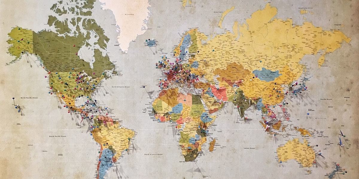
For centuries, cartography was a painstaking craft. Skilled mapmakers spent years surveying terrain, meticulously drawing coastlines, and hand-lettering place names. The resulting maps were beautiful works of art but came with significant limitations:
- Static information that couldn't reflect real-time changes
- Limited detail at any given scale
- Difficulty updating when roads or boundaries changed
- Bulky physical format requiring storage space
- No search functionality—finding a specific location meant manual scanning
The GPS Revolution: Satellites Change Everything
The Global Positioning System, originally developed for military applications in the 1970s, became available to civilians in 1983. This marked the first fundamental shift in navigation technology. For the first time, anyone could determine their precise location anywhere on Earth.
The technology relies on a constellation of satellites orbiting Earth. GPS receivers calculate position by measuring the time signals take to arrive from multiple satellites—a process called trilateration. Early GPS devices were bulky, expensive, and provided only coordinates without accompanying maps.
GPS Accuracy Through the Years
Early civilian GPS was intentionally degraded by the U.S. government through "Selective Availability." When this was disabled in 2000, accuracy improved from ~100 meters to ~10 meters. Modern GPS with augmentation systems can achieve sub-meter accuracy.
The Digital Map Emerges
Early Digital Mapping (1990s)
The first digital maps were essentially scanned paper maps—useful for viewing but lacking the transformative features that would come later. Geographic Information Systems (GIS) began enabling organizations to layer data onto maps, but these remained specialized tools requiring significant expertise.
The Internet Enables Access
Web-based mapping services in the early 2000s democratized access to digital maps. For the first time, anyone with internet access could view maps without specialized software. These early services were revolutionary but limited—slow to load, low resolution, and offering basic functionality.

The Satellite Imagery Breakthrough
The integration of satellite imagery transformed digital maps from abstract representations to photographic views of our world. Users could suddenly see their own homes from space, explore distant cities, and understand geography in ways previously impossible without actually traveling.
The Smartphone Era: Maps in Every Pocket
The introduction of GPS-enabled smartphones brought professional navigation capabilities to billions of people. This convergence of technologies created entirely new possibilities:
- Real-time location awareness: Your position updates continuously as you move
- Turn-by-turn navigation: Voice-guided directions replaced paper directions
- Local search integration: Find businesses, services, and points of interest nearby
- User-contributed data: Traffic conditions, business hours, and reviews from other users
- Continuous updates: Maps improve without requiring new purchases
The Power of Crowdsourced Data
Modern mapping services aggregate data from millions of users. Every phone reporting its speed on a highway contributes to traffic flow analysis. User reports of road closures, accidents, and hazards create real-time awareness that was unimaginable a generation ago.
Machine Learning and Intelligent Navigation
Artificial intelligence has elevated digital maps from passive reference tools to intelligent navigation assistants:
Predictive Routing
Modern navigation doesn't just show current traffic—it predicts future conditions based on historical patterns, events, weather forecasts, and real-time data. A system might recommend leaving 15 minutes early because it knows traffic typically builds at your usual departure time.
Personalized Suggestions
AI learns your preferences. If you typically avoid highways, prefer scenic routes, or regularly stop at certain types of businesses, intelligent systems adapt their recommendations accordingly.

Automatic Map Updates
Machine learning algorithms analyze satellite imagery, street view photos, and user reports to automatically detect changes in the physical world—new roads, closed businesses, construction zones—and update maps without human intervention.
The Future of Digital Mapping
Augmented Reality Navigation
AR overlays digital information onto your real-world view. Instead of glancing at a separate map, navigation instructions appear on your windshield or through your phone's camera, showing exactly which building to enter or which lane to take.
Indoor Mapping
GPS struggles indoors, but new technologies like WiFi positioning, Bluetooth beacons, and ultra-wideband signals are enabling detailed navigation within airports, malls, hospitals, and other large buildings.
Autonomous Vehicle Integration
Self-driving cars require maps with centimeter-level precision—showing not just roads but lane markings, curb heights, and traffic signal positions. Creating and maintaining these high-definition maps represents a massive undertaking that will reshape the mapping industry.
3D and Immersive Mapping
Full 3D representations of cities allow you to virtually explore destinations before visiting. Combined with virtual reality, you could "walk" through a neighborhood thousands of miles away, understanding the environment in ways 2D maps never allowed.
Privacy and Ethical Considerations
The power of modern mapping raises important questions:
- Location tracking: Services that show real-time traffic also know where users are at all times
- Data ownership: Who controls the valuable data created by millions of users?
- Digital divide: As navigation becomes technology-dependent, what happens to those without access?
- Over-reliance: Are we losing traditional navigation skills as we depend on digital tools?
Experience Modern Navigation
Try our mapping tools and experience how far navigation technology has come.
Explore MapsKey Takeaways
- GPS technology enabled the fundamental shift from static to dynamic navigation
- The smartphone era put professional navigation capabilities in everyone's pocket
- Crowdsourced data from millions of users creates unprecedented real-time awareness
- AI and machine learning are making navigation predictive and personalized
- Future developments include AR navigation, indoor mapping, and autonomous vehicle integration
- Powerful mapping technology raises important privacy and ethical questions